ASN Wikibase Occurrence # 319802
| Date: | Tuesday 3 October 2017 |
| Time: | 18:53 |
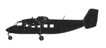
| Type: |  Antonov An-28 |
| Owner/operator: | East Wing |
| Registration: | UP-A2807 |
| MSN: | 1AJ007-14 |
| Year of manufacture: | 1990 |
| Total airframe hrs: | 3631 hours |
| Cycles: | 3197 flights |
| Engine model: | Glushenkov TVD-10B |
| Fatalities: | Fatalities: 5 / Occupants: 5 |
| Aircraft damage: | Destroyed, written off |
| Category: | Accident |
| Location: | 28 km WNW of Almaty Airport (ALA) -
 Kazakhstan Kazakhstan
|
| Phase: | En route |
| Nature: | Ambulance |
| Departure airport: | Almaty Airport (ALA/UAAA) |
| Shymkent Airport (CIT/UAII) | |
| Investigating agency: | AIID Kazakhstan |
| Confidence Rating: |
An Antonov An-28 operated by East Wing was destroyed when it impacted terrain during an ambulance flight in Kazakhstan.
The aircraft took off from Almaty at 18:35 hours local time with destination Shymkent, Kazakhstan. It impacted terrain and caught fire 12 minutes later, near the village of Mezhdurechenskoye. All five on board suffered fatal injuries.
CONCLUSION
The probable cause of the accident was the shutdown of engine no. 2 and then engine no. 1 (possibly due to a faulty shutdown).
In the course of the subsequent emergency descent due to complete loss of power of the engines with no radio communication with air traffic controllers, as well as possibly due to the resulting confusion and nervousness, the crew unintentionally forgot to switch the pressure value on the mechanical barometric altimeter of the aircraft to the pressure on the landing airfield (704 mm Hg), leaving the pressure value of 760 mm Hg, which led to incorrect readings of true altitude of the flight.
Subsequently, the crew was able to start the engines and attempt to make a forced landing at a distance of 28 km from the airfield of Almaty at night in poor weather conditions in an unlit area.
Incorrect readings on the barometric altimeter of the true flight altitude (the radio altimeter showed 750 m) resulted in the aircraft colliding with a power line, causing a fire, as well as colliding with the ground, as a result of which the aircraft structure completely collapsed and burned down.
METAR:
10:00 UTC / 16:00 local time:
UAAA 031000Z 01003MPS 9999 SCT050CB BKN100 19/04 Q1013 R23R/CLRD65 NOSIG
11:00 UTC / 17:00 local time:
UAAA 031100Z 03003MPS 9999 SCT050CB BKN100 18/04 Q1013 R05L/CLRD65 NOSIG
12:00 UTC / 18:99 local time:
UAAA 031200Z 35006MPS 9999 SCT050CB BKN100 15/08 Q1015 R05L/CLRD65 NOSIG
13:00 UTC / 19:00 local time:
UAAA 031300Z VRB01MPS 9999 BKN033CB OVC100 14/06 Q1016 R05L/CLRD65 NOSIG
Accident investigation:
 |
|
Sources:
ria.ru
zakon.kz
Kazakhstan Committee of Civil Aviation
Location
Images:

photo (c) Yura-Ala; Almaty Airport (ALA); 03 July 2017
Revision history:
| Date/time | Contributor | Updates |
|---|
The Aviation Safety Network is an exclusive service provided by:


 ©2024 Flight Safety Foundation