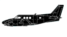
ASN Wikibase Occurrence # 35643
This information is added by users of ASN. Neither ASN nor the Flight Safety Foundation are responsible for the completeness or correctness of this information.
If you feel this information is incomplete or incorrect, you can submit corrected information.
| Date: | Monday 30 November 1987 |
| Time: | 09:46 |
| Type: |  Beechcraft C90 King Air |
| Owner/operator: | Joseph R. Leon |
| Registration: | N4463W |
| MSN: | LJ-633 |
| Year of manufacture: | 1974 |
| Total airframe hrs: | 2092 hours |
| Fatalities: | Fatalities: 2 / Occupants: 2 |
| Aircraft damage: | Destroyed |
| Category: | Accident |
| Location: | Beaufort, SC -
 United States of America United States of America
|
| Phase: | En route |
| Nature: | Private |
| Departure airport: | Savannah, GA (SAV) |
| Philadelphia, PA (PNE) | |
| Investigating agency: | NTSB |
| Confidence Rating: |
AT 0938, WHILE climbing THRU 9000', THE PLT WAS CLRD TO climb TO FL 210. APRX 10 MIN LATER, THE ATC CTLR NOTED THE ACFT'S MODE C RTRN WASN'T BEING DISPLAYED ON HIS SCOPE. HE TRIED TO ADZ THE PLT, BUT COULDN'T ESTABLISH RADIO CONTACT. THE ACFTBROKE UP IN FLT & THE WRECKAGE WAS FND SUBMERGED IN A CREEK & ON MARSHLAND. A LARGE PIECE OF THE RGT OUTBOARD WING PANELWAS FND ABT 2 MI EAST OF THE MAIN WRECKAGE. THE RGT ENG WAS FND APRX 800' TO 1200' NE OF THE MAIN WRECKAGE IN 4' OF WTR.THERE WAS EVIDENCE THE RGT OUTBOARD WING HAD FAILED FM UPWARD & AFT OVERLOAD. NO PRE-ACDNT MECH FAILURE OR MALFUNCTION WAS FND THAT WOULD HAVE RESULTED IN AN IN-FLT BREAK-UP. RADAR DATA SHOWED THE ACFT WAS climbing AT 115 KTS & 1100'/MIN; AT APRX 16,000' MSL, RATE OF climb SLOWED TO APRX 750'/MIN, THEN INCREASED TO 1200'/MIN. PEAK ALT WAS APRX 18,200'. ACFT THENENTERED A STEEP DSCNT & CRASHED. AT THE APRX TIME & PLACE OF PEAK ALT, PRIMARY TARGETS APPEARED ON RADAR & REMAINED FOR SVRL MINS. ORGANIC MTRL WAS FND ON LEFT ENG INLET SCREEN, BUT SOURCE WAS NOT DTRMD. ACDNT OCCURRED ALONG BIRD FLYWAY. CAUSE:
Sources:
NTSB: https://www.ntsb.gov/ntsb/brief.asp?ev_id=20001213X32482
AL 255
Revision history:
| Date/time | Contributor | Updates |
|---|---|---|
| 24-Oct-2008 10:30 | ASN archive | Added |
| 21-Feb-2013 11:38 | wf | Updated [Operator, Source] |
| 21-Dec-2016 19:22 | ASN Update Bot | Updated [Time, Damage, Category, Investigating agency] |
Corrections or additions? ... Edit this accident description
The Aviation Safety Network is an exclusive service provided by:


 ©2024 Flight Safety Foundation